Airport Layout Plan
and Airport Plans
Report
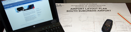
On September 27, 2012, the Division of Aeronautics submitted to the Federal Aviation Administration for their review the Draft Airport Layout Plan (ALP) and companion Airport Plans Report for the South Suburban Airport. The ALP is a set of drawings that shows the inaugural and future facilities for SSA. The ALP is prepared in conformance with the Federal Aviation Administration’s Advisory Circular 150/5070-6B, “Airport Master Plans.” Information that is typically included in an ALP are plan sheets that show runway details and data, approach and departure profiles, airspace protection surfaces, obstruction information, meteorological data, terminal area plans, land-use information and airport property maps. The Airport Plans Report provides additional definitions and guidance used in the preparation of the SSA ALP.
If you have any comments or questions about this report, please visit the "Contact Us" page and let us know.
- Entire Airport Plans Report (Sept. 7, 2012) (38.8 M)
- Report text only (2,414K)
- Report appendices only (18,390)
- Airport Layout Plan (Sept. 7, 2012)
- Cover Sheet (549 K)
- Vicinity Aerial – Existing Land Use
Drawing (2.6 M) - Inaugural Airport Layout Plan
Drawing (5 M) - Inaugural Airport Data Sheet (860 K)
- Inaugural Terminal Area Drawing 2.2 M)
- Inaugural Airport Airspace Drawing (11.1 M)
- Inaugural Runway 9R Inner Portion of the Approach Surface Drawing (1.2 M)
- Inaugural Runway 27L Inner Portion of the Approach Surface Drawing (1.2 M)
- Inaugural Runway 9L Inner Portion of the Approach Surface Drawing (1.4 M)
- Inaugural Runway 27R Inner Portion of the Approach Surface Drawing (762 K)
- Inaugural Airport Land Use Drawing (2.7 M)
- Inaugural Airport Property Map (2.6 M)
- Inaugural Airport Property Map Data
Sheet (184 K) - Future Airport Layout Plan Drawing (10.8 M)
- Future Airport Data Sheet (1.3 M)
- Future Terminal Area Drawing (3.4 M)
- Future Airport Airspace Drawing (11.2 M)
- Future Runway 9L Inner Portion of the Approach Surface Drawing (1.4 M)
- Future Runway 27R Inner Portion of the Approach Surface Drawing (1.3 M)
- Future Runway 8R Inner Portion of the Approach Surface Drawing (1.7 M)
- Future Runway 26L Inner Portion of the Approach Surface Drawing (1.4 M)
- Future Airport Land Use Drawing (3.3 M)
- Future Airport Property Map (3.5 M)